Western Bay of Plenty District
Data Summaries
These infographics provide insights into individual communities and wards within the western Bay of Plenty District.
Commissioned by Western Bay of Plenty District Council
14 individual infographics have been developed by SociaLink’s Community Insights team to provide local insights into areas such as He Tangata | Our People, Households and Housing, Income & Community, Education and Employment, Ngā Iwi Māori and Deprivation Levels.
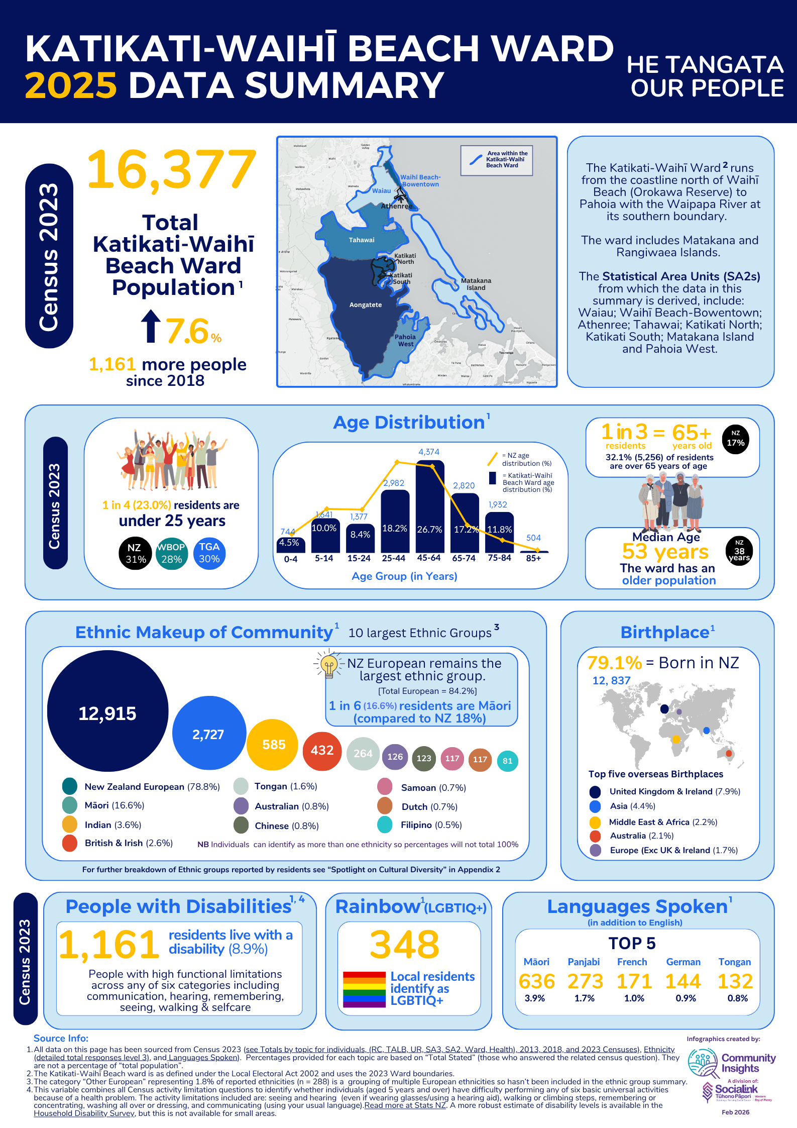
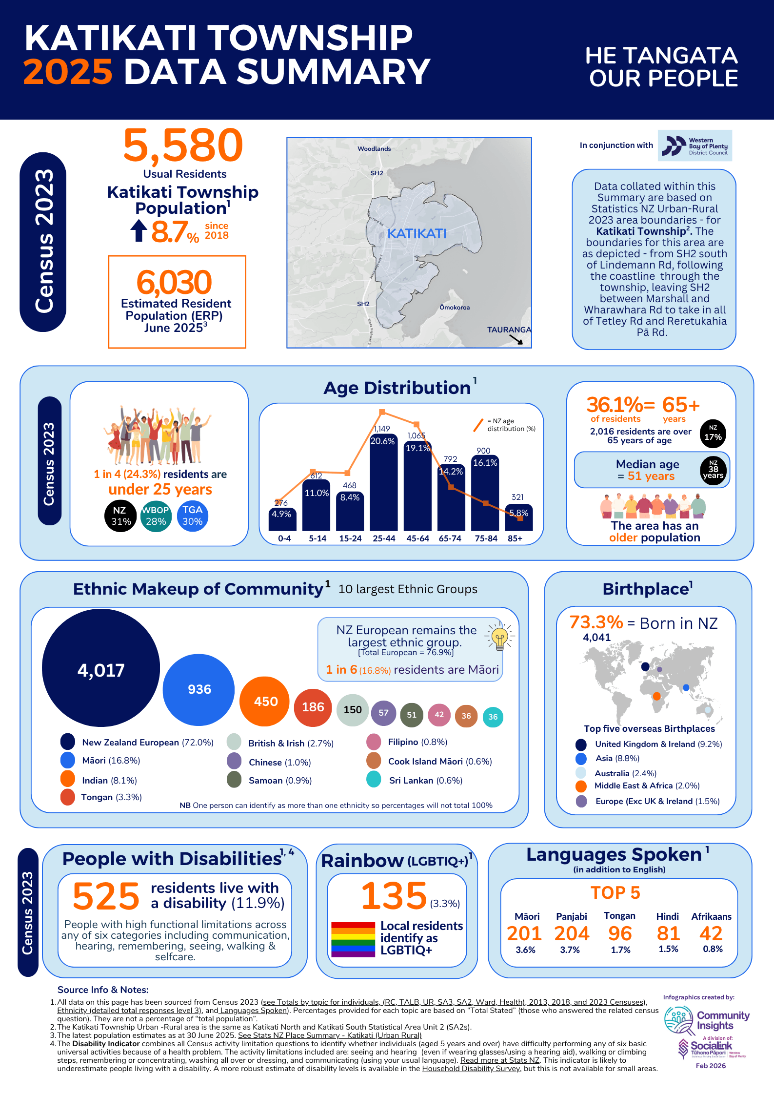
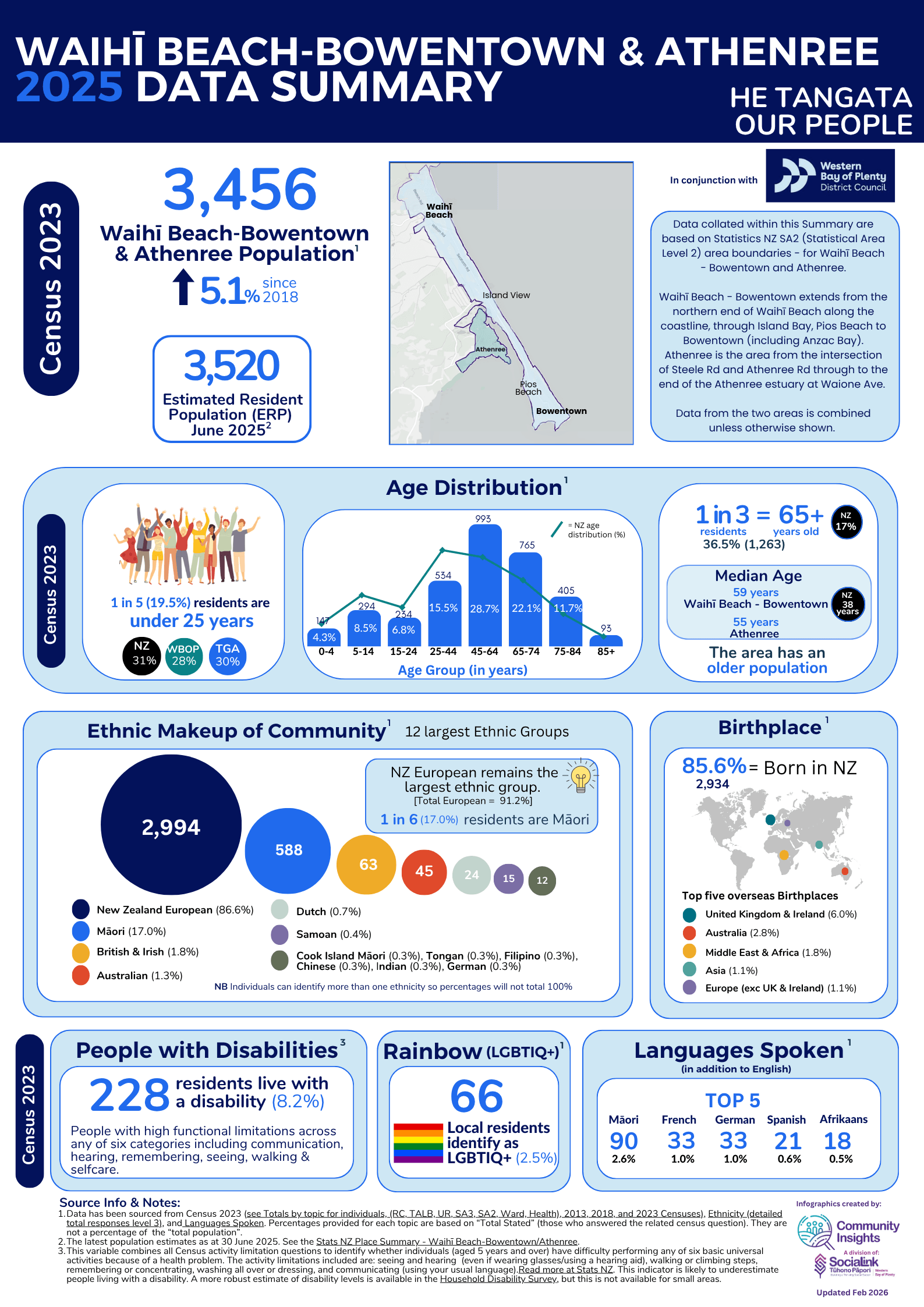
Katikati-Waihī Beach Ward
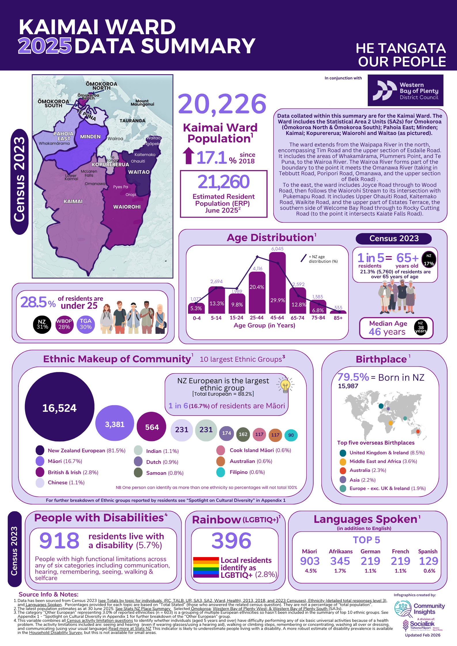
Kaimai Ward
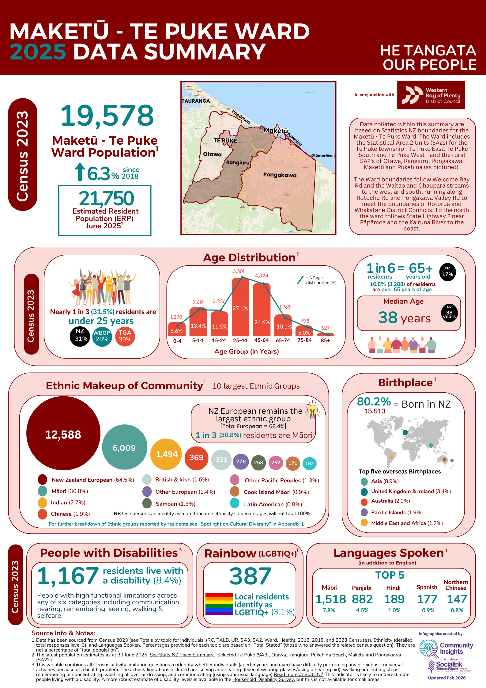
Maketū-Te Puke Ward
Disclaimer
The information contained in these infographics has been compiled from various sources including Census 2023, StatsNZ, Ministry of Education, Māori Maps, Marae and Te Whata| Iwi area of interest and University of Otago ( Socioeconomic Deprivation Indexes). While we endeavour to ensure the accuracy of the data collected and presented SociaLink cannot accept any liability for any inaccuracies.
Navigating the infographics
Click on the front page image or the "View infographic" button to view the 5+ page Data Summary selected. "Download PDF" option is also available for a copy of the infographic.
Get in touch!
Get in touch with the Community Insights team to talk with us about your data needs, questions or ideas. We’ll support your organisation to build your skills and expertise in using both your own and relevant external data to enhance and grow your work in our community.

Call us: 07 987 0920
Visit us: The Kollective – 145 17th Ave, Tauranga
Mail: DX BOX HP40007, Tauranga 3112
Terms of use and privacy policy

